Kvalitní cestovní pojištění
do zahraničí i do ČR.
Cestovní pojištění jednoduše, rychle a online na Top-Pojištění.cz s okamžitou platností a se slevou až 50 %.
Nejlevnější cestovní pojištění
na celý rok už od jediné koruny na den.


Ještědsko-kozákovský hřbet (JK)
Ještědsko-kozákovský hřbet: Unit photos | Add photo | Add information
Move on: Ještěd
Related links: Krušné hory | Ještědsko-kozákovský hřbet | Jizerské hory | Krkonoše | Orlické hory | Králický Sněžník | Hanušovická vrchovina | Rychlebské hory | Hrubý Jeseník | Moravskoslezské Beskydy | Hostýnsko-vsetínská hornatina | Javorníky | Novohradské hory | Šumavské podhůří | Šumava | Český les
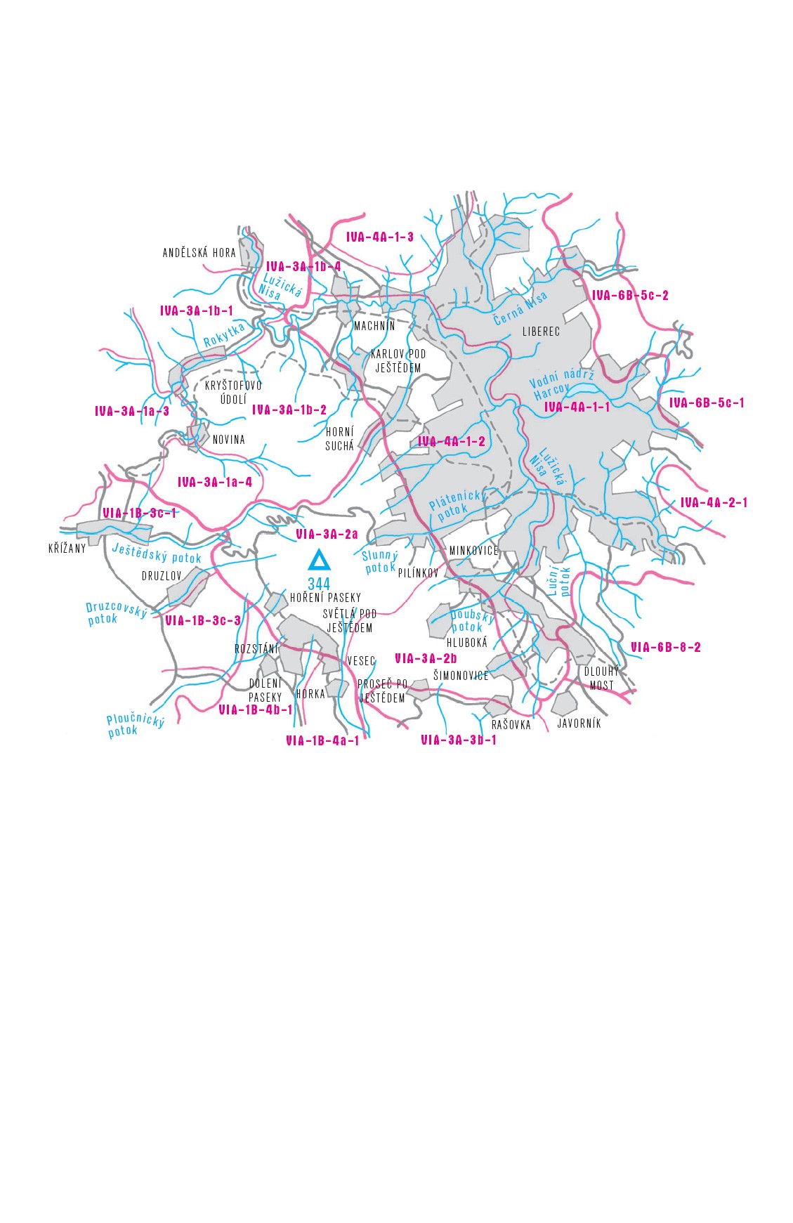
The Ještědsko-kozákovský Ridge is a compact montane to highland region, almost 60 kilometers long and 5–15 kilometers wide. At the northwest, the Ještědsko-Kozákovský Ridge begins with Horní sedlo at the foot of Ostrý vrch, which separates it from the Lužické Mountains. The peaks gradually rise over 800 meters above sea level and culminate to the southwest of Liberec with the grand summit Ještěd, which is the only one exceeding the one-thousand meter limit. The ridge further continues to the southeast and is crossed by the deep valleys of the Jizera and Mohelka Rivers. The last mountain over 700 meters above sea level is Kozákov, after which the elevation progressively drops. Geographical aspects that are of interest are the silica rockeries and the boulder fields. Rock composition is very diverse, sedimentary, igneous and metamorphic rocks are all represented.The Ještědský Ridge is mostly forested; the Kozákovský Ridge is covered with a mosaic of forests, meadows and fields. Most significant, from a naturalistic point of view, are the well-preserved beech forests surrounding the Kryštofovo valley (Karlovské Bučiny National Nature Reserve).Easy accessibility in combination with beautiful nature have resulted in almost 200 years of lasting interest in this area by tourists. One of the first mountain associations in the Czech Republic was established in this region. A well-marked trail system allows for any type of hike and is, moreover, accompanied by all necessary amenities.